Our training rides are proving a great opportunity to explore this fabulous city of ours. We’ve seen a lot of it in the years we have lived here but nothing brings it all together like pootling around on a bike. You also get to see the interesting bits between the ‘places’ – the areas you normally just slide under on the tube.
It’s also good to use these early long rides, where we are not too concerned about pace, to find the best places to cycle good distances so we can build up a library of sections without too many interruptions that we can combine into training routes. Richmond Park is great, but we don’t want to be going and lapping that four times a week!
This week’s long ride took us to a number of London landmarks that we’ve not previously been to. We planned the route beforehand, targeting breaking the 50 mile barrier for the first time. The theory: a scenic route to Greenwich, under the Thames via the foot tunnel to the Isle of Dogs, head north to the Olympic park then east out along the Greenway to the Woolwich Ferry. Taking the ferry south of the river, we’d head via the Thames Path and Greenwich once more to CS7 – our usual cycle route home from work.

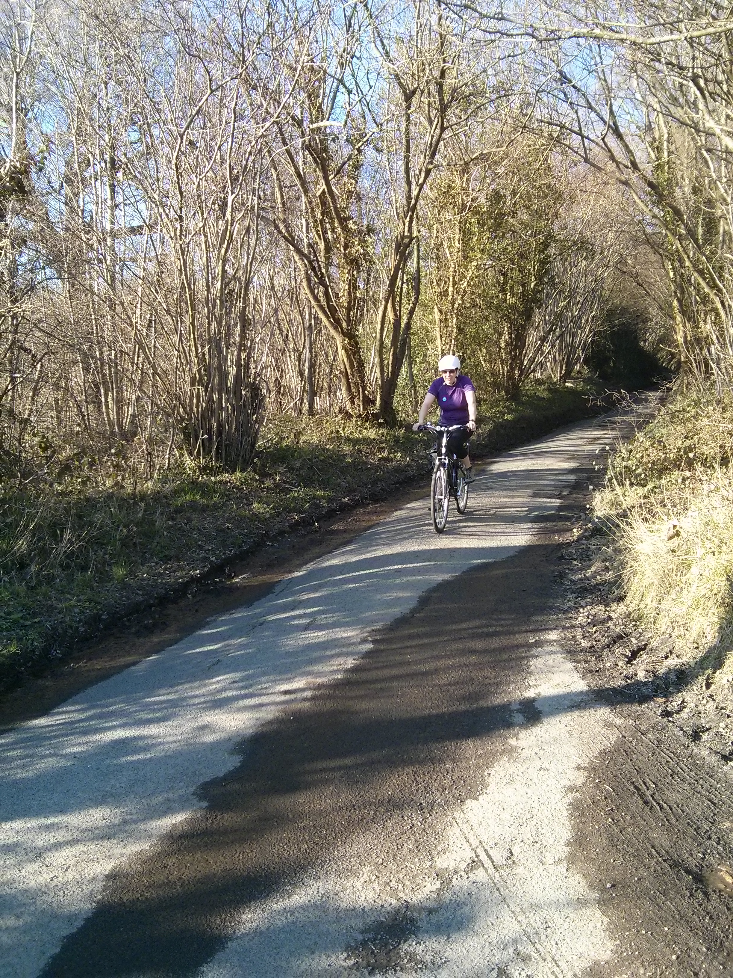
We started very strongly – a good pace along the Wandle Trail and up to Battersea Park for a lap there. This stretch definitely makes it into the list of useful segments for our rides, little interaction with traffic and mostly a sensible amount of space to ride, meaning a decent pace is relatively easy.
As with last week, we headed along CS8 on Millbank, but this time we crossed back over the river before Westminster to avoid Parliament Square (it’s very scenic and all but an utter cow to cycle around). Coming off the bridge, I went to go through some traffic lights on amber and looked back to realise Audrey wouldn’t make it through the lights, so stopped suddenly with no chance to unclip, giving me my only zero-speed falling-over due to cleat issue of the day. Still not there…
We stopped off at Kerb (an excellent roaming street food market) who were set up behind Royal Festival Hall and got some fabulous cakes from Kooky Bakes – ‘Born in the States. Baked in Britain’. The American sheep among us wasn’t going to turn down an Oreo peanut butter brownie or anything resembling a seven layer bar. Highly recommended by both of us and great cycling fuel!
Heading through Southwark was slow going – the route we had planned went through some tourist-heavy areas which were very busy with pedestrians so we attempted to divert around but ended up in the middle of Borough Market – also rammed full of pedestrians. It didn’t improve much from there until we managed to get back to our planned route at the far side of London Bridge – which took several failed attempts that ended in dead end streets or one-ways in the wrong direction. Even once we rejoined our route, some of the cycle route (NCN1 again, I believe) was simply laughable, with bone juddering cobbles and so many left and right turns.
After what seemed like an age of this (in reality it was probably just a few miles), and pretty depressed about our route choice, we reached Rotherhithe where Audrey had suggested we take the road around the perimeter of the peninsula instead of cutting across. This was a great idea, as the road is wide and nicely surfaced but has little traffic as there’s no reason to want to drive there unless you’re a resident. We headed through the pleasant Russia Dock Woodland and then continued on our way towards Greenwich.
After a brief stop for some of our cake, we said a quick hello to the Cutty Sark in Greenwich then walked through the foot tunnel to the Isle of Dogs. Thankfully the lifts at both ends were in operation! We continued to follow NCN1 on the north of the river, which once again was leaving no junction left unturned – another endless sequence of lefts and rights which made for very frustrating cycling. This slow process eventually brought us up to the bottom of the Regents Canal just north of Limehouse Basin where the canal meets the Thames, and we were finally able to stretch our legs again along the towpath to Victoria Park.
We picked up some baguettes and ate them in the park, trying to learn from last week’s failure to eat early enough during the ride. Even so, it was still nearly 4pm and we were only just having lunch, so arguably we still haven’t got this right. At least we had kept ourselves better topped up with cake and Haribo before lunch this time.
A lap and a half of Victoria Park then we reached the fabulous Greenway – the best use of a sewage outflow you’re likely to see. For those unfamiliar with it, the Greenway is a linear green corridor with a wide paved path running from Victoria Park in Hackney out 4.5 miles east to Beckton, and other than fairly occasional road crossings it is pretty much interruption free*. It runs on top of the enormous Northern Outfall Sewer, part of Joseph Bazalgette’s grand Victorian sewage system for London, which takes the capital’s crap far enough away that it can be discharged into the Thames without the tide bringing it back into central London. These days it is, thankfully, cleaned and treated at Beckton before being dumped in the river. Near the start of the Greenway is the delightful-looking (no, really) Abbey Mills pumping station which hefts sewage up 40-odd feet from the underground sewers which run along the Embankment to the height of the northern outfall. Anyway, enough of this crap – I assume you’re mostly here to read about cycling or charity or us, not sewage infrastructure geekery.
* Interruption free, aside from a short but awkward temporary gap when you reach Stratford (Crossrail works, according to Open Street Map), necessitating a walk through a temporary diversion really not set up for cycling, and a short stretch of the segregated CS2 Extension which was interesting to see in the flesh, along Stratford High Street, before rejoining the Greenway.
We made our way to Beckton on the Greenway and reached what we thought was the end – a rather major intersection of the A13 and A117 dual carriageways. Thankfully there was, at least, toucan crossings so we didn’t have to play with the nine lanes of cars. It took a while to negotiate all the crossings – fine for a leisurely ride but must be very annoying for anyone doing it frequently. We took a short stretch of CS3 (I had no idea it got that far east) then back on the Greenway for a surprise last few hundred metres which were severed from the rest by these major roads. There was some evidence that it once connected through but it appears to be very closed now, whatever that route was.
From the end of the Greenway, we followed a good (but wouldn’t want to do it alone or at night) off-street cycle path down towards the Woolwich Ferry. The cycle path eventually became a narrow cycle lane at the side of a busy main road, then nothing at all. Luckily the footpath over the huge road bridge out past London City airport to the ferry terminal is shared space as that did not look like a nice road to cycle on – heavy with fast moving traffic and zero space to escape to. There is also a cool point about two thirds of the way across the bridge where you are absolutely in line with the runway, with the landing lights both in front and behind you.
There was an enormous queue of cars for the ferry, which the British part of me felt rather bad about cycling past, but presently we made it on to the ferry and over the river: another bit of London infrastructure ticked off the to-do list. The ferry was fun and cycling onto/off it was fine; I wouldn’t exactly say it was set up for cycling though – you use the area set aside for motorbikes and have to ride off in front of all the cars. Fine for reasonably confident cyclists as we are; not so sure it would work well for a family though.
Once south of the river, we began tacking back west along the Thames Path, which was variously very good, or middling, or on more than one occasion entirely missing. Overall though, for much of this stretch it is very good for cycling along – wide enough to easily coexist with the few pedestrians out that way without having to pootle too slowly.
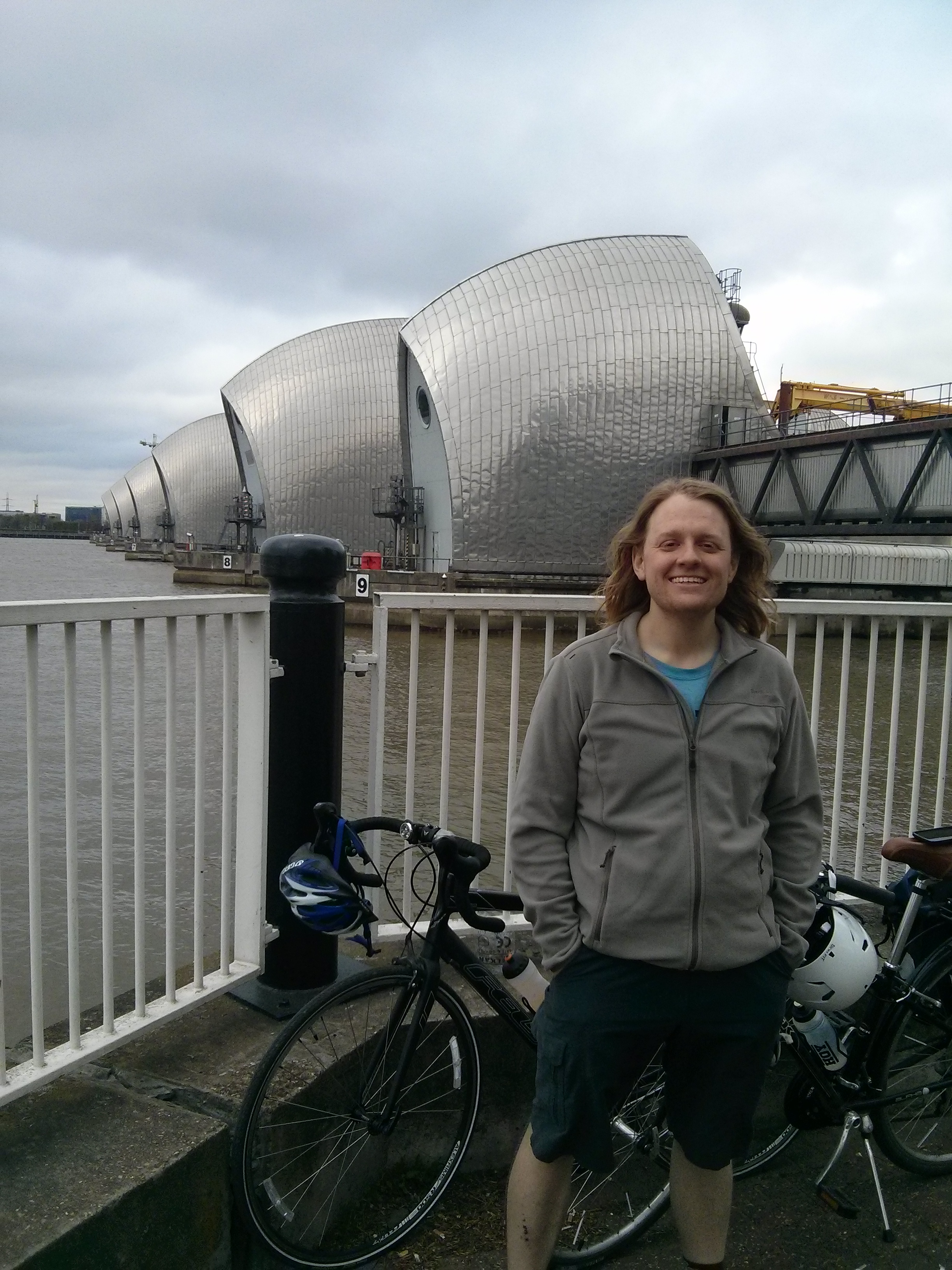
Along this stretch, we went by the Thames Barrier, which protects central London from flooding by preventing the tide flowing up the river at times of high water flow, another thing we’d been meaning to see for years. We used this opportunity to have the last of our cake and snap a few shamelessly touristy photos.

Disaster strikes
Continuing on, the loop around the back of the Millennium Dome O2 continued the decent quality track, until it eventually degenerated into a building site. Around this point, Audrey’s knee started giving her major trouble. We’d done about 40 miles at a relatively sedate pace, so we will need to work out what caused this. More pressing, however, was the quandary of how to get home, some 15 more miles by our planned route. The main options we could think of were to limp back home very slowly (taking hours and risking further injury), or to try and shortcut our way back to somewhere we could take a train from.
We weren’t far from Greenwich, but the train options from there weren’t very helpful, so we ended up tacking back across to Southwark very slowly (nevertheless, still adding another 8 miles), where Audrey was able to leave her bike at work and tube home; I cycled the remaining 9 miles home from there via CS7, Clapham and Wandsworth Commons, and the Wandle Trail (which was like cycling while being pelted with a thick hailstorm of rice as it had so many swarms of flies hovering around it). By the time I made it home my hair was storing more insect life than a Venus fly trap with the munchies.
In Summary

Overall, a mixed bag of a ride. The good: some good bits of route found, several landmarks visited, some awful bits of routes found (good to know to avoid in future), our longest rides yet (even Audrey’s curtailed 48 miles were a few miles longer than our longest previous ride). The bad: those awful bits of routes really weren’t fun or fast to cycle, Audrey’s knee troubles are a concern that we’ll need to get on top of pronto, and the overall pace even up to that point was very slow other than the first stretch.
Overall ride summary:
- Distance: 48 miles (Audrey), 57.3 miles (Mark)
- Elevation gain: (check)ft (Audrey), 1,937ft (Mark)
- Average moving speed: 10.5mph
- Time: 5h28m moving, 8h26m total
- Total training miles to date – Mark: 199.7 miles, Audrey: 183.4 miles